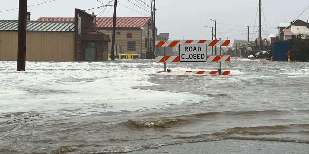
The City of Nome’s focus is on infrastructure as clean-up crews move towards the east end of town and assess damages in the areas outside city limits.
UPDATE: Significant flooding occurred in various businesses on Front St. including to Wells Fargo Bank, the Post Office, and several other buildings. However this damage is not as visible from the outside.
By September 19th, a transformer that blew at the state office building was the most visible damage, but aside from that Nome’s downtown area looks in good shape. That was City Manager Glenn Steckman’s assessment during a recent emergency operations meeting.
“Considering what you got impacted, I think the city looks pretty good and unfortunately there is probably millions of dollars of damage going outside the city,” Steckman said.
After significant cleanup efforts from many local volunteers, a storm recovery version of Nome is what some visiting tourists saw on Sept. 19. The next scheduled cruise ship Le Boreal was able to stop into town for the day, Port Director Joy Baker said.
Baker recommended the city have an inspector from the U.S. Army Corps of Engineers take a look at the bridge at the causeway and other port infrastructure. The lingering question was about the condition of the port’s fuel lines which Baker said has now been addressed.
“We’ve done an air test on the lines and the pressure held on all three lines last night. So we are…calling it. And we talked to Seeker’s and he agreed the pressure stayed good all night, that we can use the lines. And after the Utility (NJUS) fills in the line then we will hydro test that one,” Baker said.
Baker and the City of Nome also shared that the Association for Alaska Harbormasters Conference, scheduled to convene in Nome next week, was moved to Anchorage while the community is focused on storm recovery.
Looking outside city limits, the dock area around Cape Nome and the surrounding landscape are completely changed. Alaska Sea Grant biologist Gay Sheffield was taking water samples and assisting stranded marine mammals in the Cape Nome area, which is unrecognizable.
“The rocks from the south end are now filling in and have been moved so that it’s all rocks filled into the north side of the pier. You can’t sample there anymore because there’s no water there. It’s just filled with boulders,” Sheffield said.
East of town, the City of Nome is still assessing the full extent of the damage at places like Fort Davis, to the cabins and subsistence areas that are vital to Nome residents, and to the Safety Sound bridge near mile 22.

Calvin Schaeffer, the Western District regional manager for DOT confirms there is a new channel flowing between the Bering Sea and Safety Sound.
“We’re looking at putting a dozer down at 16 miles right now to start finding a road in there and get through to Safety to the bridge. Then assess what we’re going to do on that side of it, with the big washout there and new channel. It’s way in there,” Schaeffer said.
It is currently unclear how many Native allotments and subsistence camps were affected at this point. However, Schaeffer says several cabins were moved across the lagoon by the rising water and are now standing in new locations.
Gov. Mike Dunleavy is planning to visit Nome on Sept. 21 to see the damage for himself.
*Correction/Update: The original version of this story mischaracterized the damage that was done to Nome’s Front St. KNOM apologizes for this mistake and has updated the wording to better reflect this.
Image at top: Front street closed due the storm the weekend of Sept. 17. Photo by Scotty Campbell, KNOM (2022).


