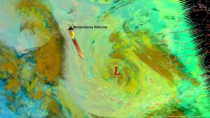
The National Weather Service is forecasting coastal flooding in Nome and across Western Alaska the weekend of Sept. 16, with potential storm surge reaching up to 14 feet above normal levels. If this multi-day fall storm hits Western Alaska as predicted, it would reach record levels rarely seen over the last 50 years.
“Coastal flooding is certain this weekend, the only question is how bad,” climatologist Rick Thoman with the Alaska Center for Climate Assessment and Policy at the University of Alaska Fairbanks said.
Thoman told KNOM via email that the latest information suggests Nome will see some of the highest ocean levels ever recorded since the local sea wall was constructed. Nome’s seawall was completed in June of 1951, according to the U.S. Army Corps of Engineers, but updated to something similar to its current form in the mid-1970s. Overall, where coastal flooding is the most severe in the Bering Strait region, and how it impacts regional communities, will depend on the timing of the highest water and tides, Thoman said.
Based on the latest forecast from the NWS office in Fairbanks, released at 3 p.m. Sept. 14, significant storm surge and high wind will affect the coast of Western Alaska from Point Hope south to Hooper Bay starting tomorrow.
NWS currently estimates water levels will rise between eight and 12 feet above normal high tides in the Nome area, with the likelihood of the Council Road being completely covered in water.
This storm could be just as damaging as the November, 2011 Bering Sea superstorm and have similar coastal flood impacts, according to NWS. The City of Nome announced on social media that the residents in Belmont Point area should be prepared to evacuate if necessary.
Even the UAF research vessel Sikuliaq that was docked in Nome the afternoon of Sept. 14 left town and headed north ahead of schedule in order to avoid the worst of this deep, early fall storm.
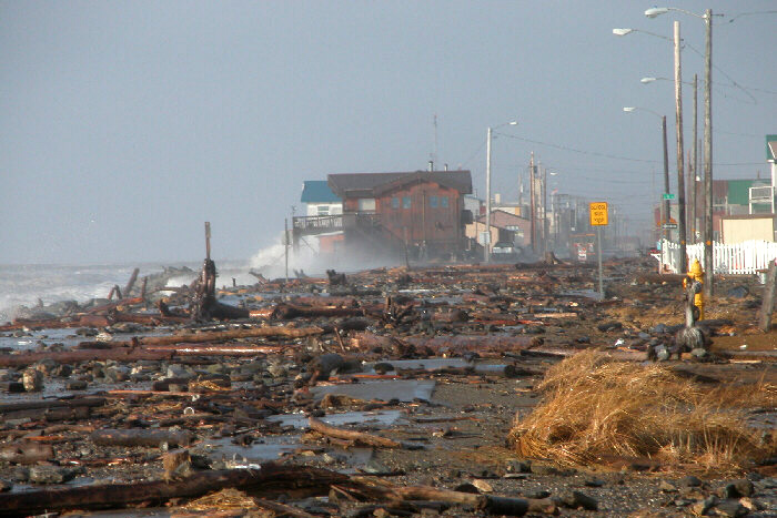
Image at top: The aftermath of the infamous storm that ravaged Nome and environs in October 2004. Here is the east end of Nome’s Front Street just after the storm had passed, littered with driftwood and large rocks. KNOM provided live coverage and emergency advisories throughout the event. (Photo from KNOM file, 2004).


