A highly-specialized plane, a first-of-its-kind camera, and high-tech buoys are at the center of a project backed by the National Oceanic and Atmospheric Administration (NOAA). The project called “Arctic AIR” is back in the Bering and Chukchi Seas this summer to conduct studies of sea ice retreat and phytoplankton. The researchers seek to better understand rapid changes occurring in the Arctic’s marine ecosystem due to climate change.
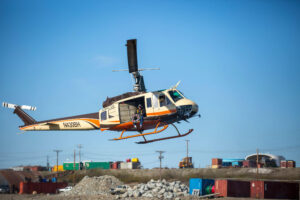
The mission, led by Chief Scientist Jiaxu Zhang, is conducting aerial surveys using a custom De Havilland DHC-6-300 nicknamed the “Twin Otter”. The aircraft is equipped with a modular bay in the floor for mission-specific instruments that can easily be swapped in and out.
“The NOAA engineers have been working really hard to modify this airplane to fit in all the instruments that our scientists want to put there. All the cameras, all the buoy deployment capabilities, meteorological sensors, everything,” Zhang said.
Included in Arctic AIR’s set of sensors is an innovative hyperspectral camera used to survey the water beneath the aircraft. The camera captures detailed spectral information across a wide range of wavelengths, including those outside the visible spectrum.
Hyperspectral cameras can even distinguish different types of phytoplankton due to each species’ unique color. This capability is invaluable for identifying harmful algal blooms (HAB), or as Zhang calls them, “the bad guys”.
“The villains, specifically here, is the Alexandrium catenella. They produce a toxin that can pollute the shellfish or the zooplanktons, and this toxin will be passed to the fish and marine mammals,” Zhang said. “If you go get a shellfish and eat it, that toxin can be really harmful for human health.”
The research is being done in coordination with several local entities including Norton Sound Health Corporation, University of Alaska Fairbanks (UAF), and Alaska Sea Grant. Researchers from each organization witnessed the Bering Sea’s 2022 HAB event, now believed to be the largest, most persistent, and toxic ever documented nationwide.
The coordination is part of an effort to collect data at various levels to perform “ground-truthing”. When species of algae are identified by Arctic AIR’s hyperspectral camera, they can radio down to ships like UAF’s R/V Sikuliaq to conduct water sampling and confirm their findings. NASA’s recently launched PACE satellite, equipped with a much larger hyperspectral camera sensor, will also be used by the researchers for their study.
High-Tech Buoys
The broader theme underlying Arctic AIR’s efforts is climate change, with warming waters being more conducive to both HAB events and changes to annual sea ice patterns. The team hopes to better understand what part of that sea ice retreat is caused by warmth in the atmosphere and ocean and what part is caused by winds blowing the ice around.
Michael Steele is an Oceanographer from the Polar Science Center and Applied Physics Lab at the University of Washington. The co-lead on the Arctic AIR project has been deploying buoys in the arctic for about 15 years. Steele explained how climate warming is changing the environment in the Arctic, where the warming rate is four times higher than the global average.
“Climate warming is definitely responsible for the earlier and earlier retreat of sea ice that we’re seeing. As the ice melts, it stratifies the ocean because that meltwater is light and it sits on top of saltier water below,” Steele said. “So there’s all sorts of wonderful interaction between warming water, retreating ice, and stratification.”

His work has contributed to numerous articles, including the recently published “High-resolution modelling identifies the Bering Strait’s role in amplified Arctic warming”. The article attempts to link the presence, or lack thereof, of sea ice in the Bering Sea with overall climate warming. Simulations performed by the authors of the article revealed a “clear correlation” between changes in Bering Strait ocean heat transport and future arctic warming. The article demonstrates how critical the presence of sea ice in the Bering Strait is to climate warming, particularly in the Pacific.
To conduct research on sea ice and water patterns, Steele has developed a variety of buoys including the ”UpTempO”. The buoy measures data such as temperature, water salinity, atmospheric pressure, and wave height and direction.
“This is really important to understand the acceleration that we’re seeing in terms of warming in the Arctic that’s more intense than anywhere else in the globe,” Steele said.
For Arctic AIR, Steele teamed up with Dr. Jim Thomson from University of Washington’s Applied Physics Lab to develop a series of expendable “microSWIFT” buoys. The water bottle sized buoys are deployed through a small tube at the back of the Twin Otter aircraft. Like the UpTempO buoy, they’re equipped with an Iridium satellite phone, allowing Steele to gather data in near-real time. The data is automatically uploaded to Steele’s website for free public use.
“We’re typically taking data once an hour and they’re just sending the data to the satellite, and then it just appears on my laptop or even my phone pretty much instantly,” Steele said.
Steele hopes to add a Photosynthetically Available Radiation (PAR) sensor to the microSWIFT design. Since phytoplankton rely on light for photosynthesis, the PAR sensor could provide data on the light conditions that influence their growth and distribution.
Future Plans
Looking to the future, Zhang hopes Arctic AIR’s work can be used create an early warning system for HABs and other environmental anomalies.
“The ocean is so vast, and we have limited resources. We cannot go there every day and keep collecting samples, which is ideal, but we cannot do it,” Zhang said. “So we want to let people know where is the best place to go to collect samples.”
Arctic AIR wrapped up their Nome fieldwork on June 6. The team is headed north to Kotzebue for 10 days of study in the Chukchi Sea. They plan to return to the Bering Strait region in September for additional surveys.