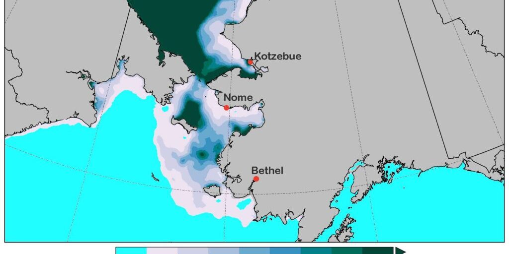
Sea ice extent in the Bering Sea was at record low levels at the end of 2020. And with recent strong northerly winds combined with mild temperatures, sea ice coverage in the Bering Strait region is still not ideal.
Based on the latest information from the Alaska Center for Climate Assessment and Policy, there’s a stark difference between sea ice in areas near Kotzebue Sound and anywhere south of Shishmaref. Climatologist Rick Thoman says sea ice along the Southern Seward Peninsula coast has to keep restarting the freezing process.
“Along the Southern Seward Peninsula coast, there’s much thinner ice generally less than a foot thick away from the immediate coast. And that’s in part also due to the same north winds. What we have is the north winds pushing the ice away from the land along the Southern Seward Peninsula coast and so the ice there has been much more mobile as everyone has seen.”
– Rick Thoman
The total Bering Sea ice extent as of Friday, January 22nd is still slightly below the long-term normal for sea ice extent, but Thoman says it’s better than it has been in recent years.
This follows December, 2020 that featured the third lowest average sea ice extent in 43 years of satellite data. Not only did sea ice form later in the Bering Sea this winter, but Thoman says it has been much milder thus far into the season compared to last winter.
“From what we can tell based on our short satellite record, and just from people’s experiences before there were satellite estimates, sea ice in most places is very thin at this point in late January. Again, that’s not surprising given how late it formed. It just hasn’t had the time to thicken up.”
Thoman would go on to say that the satellite imagery cannot determine the quality of sea ice and distinguish if it is a solid ice pack or jumbled ice pushed on top of itself.
Despite the thin ice conditions along Nome’s coast and elsewhere in the Norton Sound, Thoman says there is a good chance of sustained colder weather going into early February.
“As we go into the very end of January and the early part of February, we will see high pressure building over Chukotka and that air will quickly become very cold and we’ll see that push south across the Eastern Bering Sea including the Seward Peninsula. And with that, much colder temperatures will help with freezing up the ice.”
According to Thoman, he doesn’t expect there was much change in sea ice extent after the latest winter storm blew through the Norton Sound last week. There were strong winds at 50mph or higher in the Nome area, but Thoman pointed out that those didn’t last long.
Image at top: Bering Sea sea ice extent shown by Alaska Center for Climate Assessment and Policy on January 19th, 2021. Photo provided by Rick Thoman, ACCAP (2021).


