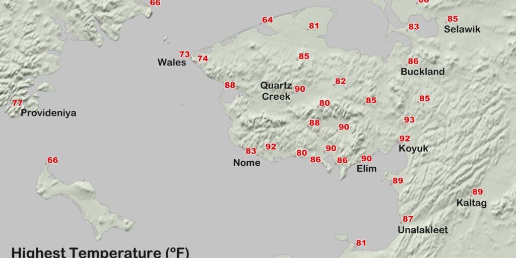
Temperatures in the Norton Sound region have come back down to normal following several days of 80 to 90 degrees. But scientists say the heatwave could return later this summer, especially in coastal areas.
Earlier in the week featured near-record and record temperatures alike across Western Alaska. As one example, climatologist Rick Thoman says it reached 87° Fahrenheit in Unalakleet on Tuesday.
“And that looks like it ties the all-time record high for Unalakleet, last set back in June of 2013, and years before as well.”
In Nome, it reached 83° F on Tuesday, which tied the daily record high set for that day.
Thoman says Tuesday was the third day in a row the Gold Rush City felt temperatures of 80 degrees or higher this week.
“(A three-day streak of 80+ temperatures in Nome) has only happened once before, back in July of 1968. Of course, even warmer temperatures a little bit inland with unofficial, but probably reliable, temperatures up around 90 degrees (have been) reported the last couple of days at Dexter.”
Other communities that got up to 90° or higher this week include Elim, Koyuk, and the Council area.
In addition to the short-term increases in heat around the state, the National Oceanic and Atmospheric Administration has tracked temperatures for Alaska as a whole. Thoman explains that this latest, 12-month period ending in June has set a new precedent.
“The July-to-June average temperature for the state of Alaska as a whole was, for the first time in 95 years of record, above freezing according to NOAA’s analysis. And (that), of course, is the warmest July-June period of record.”
According to Thoman, winters feature the most variable temperatures, so this upcoming season will help determine how the 2019-to-2020 period averages out.
Although it’s too early to tell if next year will also be record-breaking and continue the warm trend across Alaska, Thoman says we’re already off to a hot start.
Image at top: A map of 2019 summertime highs across Alaska. Photo shared with permission from Rick Thoman, ACCAP.


