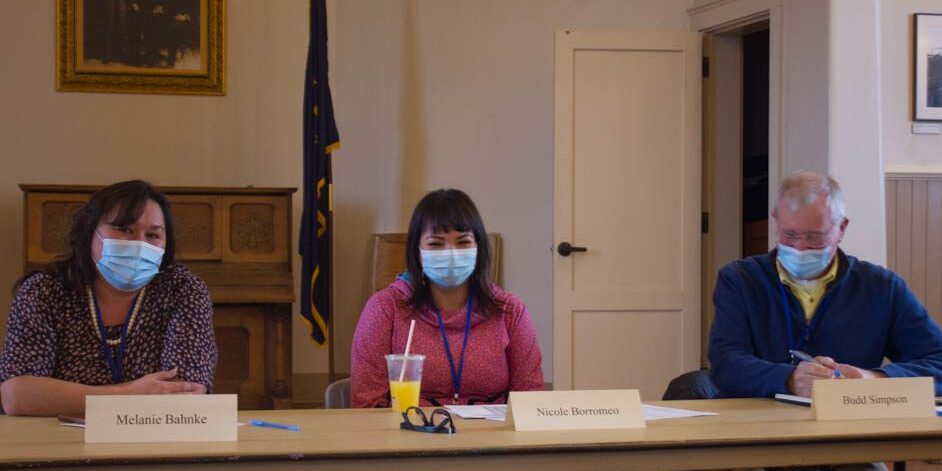
The Alaska Redistricting Board is on a grand tour of the state, inviting comments from the public to help them create the best possible electoral map for Alaska. On Oct. 11, they were at Old St. Joe’s in Nome, with six different proposed electoral maps on display.
According to data from the U.S. Census Bureau, each electoral district is supposed to contain as close to 18,335 people as possible. But there are other legal requirements of redistricting.
“We are bound by the three constitutional provisions that are laid out in Article VI (of the Alaska Constitution), which is the districts have to be compact, contiguous, socioeconomically integrated. … We want to see the districts retain their individuality and not have too many regions — especially native cultures and regions — crammed into a district just for population’s sake,” board member Nicole Borromeo explained.
But because of how diverse Alaska’s population is, electoral maps have to make compromises to ensure equal representation for all Alaskans.
“What’s tough is — in these larger rural districts — finding 18,335 people. … Where Nome is, and then a number of the other villages, we’re trying to keep it basically a coastal district,” board member Budd Simpson said.
The redistricting board’s solution is to group some of the Lower Yukon villages together with those in the Norton Sound and Bering Strait region. Some of the other maps showed the district including some Upper Yukon and Upper Kuskokwim villages.
“The Nome region is a particularly tough area to draw, because the population math meant that no matter how you did it, it had to blend different cultural and economic regions in rural Alaska into the same district because the Nome census area has approximately 10,000 people. So the additional 8,000 needed for the district have to come from another distinct area,” David Dunsmore, a representative of Alaskans for Fair Redistricting, said.
The current district map includes communities from both the Upper and Lower Yukon, though some communities in the middle are part of other districts. But the region’s population has grown in the 10 years since the last census, so the new district could cover a much smaller geographic area.
The board probably won’t select any one of the currently proposed maps as the final version.
“I think it’s more likely we’re going to pick and choose parts or districts from a number of different proposals, rather than any one map that you’re looking at now. We are getting input from the communities that we visit and people are putting in written comments constantly. We have hundreds and hundreds of written submissions that we’re looking at,” Simpson said.
The Alaska Redistricting Board’s deadline for a final map is Nov. 10. To view the proposed maps, submit comments to the redistricting board or draw an electoral map, visit the Alaska Redistricting Board website. Comments may also be mailed to:
Alaska Redistricting Board
P.O. Box 240147
Anchorage, AK 99524
Image at top: Alaska Redistricting Board Members Melanie Bahnke, Nicole Borromeo, and Budd Simpson at Old St. Joe’s in Nome during the board’s public hearing. Photo by Sean Milligan, KNOM.


