Crisp 40 degree temperatures, sunny skies, and smooth flying were a treat for the Arctic AIR team when they were last in Nome in June. Fast forward to September, blustery conditions and low clouds are making the team’s critical algae research a bit more challenging. Still, the team is persevering thanks to the dedication of the National Oceanographic and Atmospheric Administration’s (NOAA) corps of talented pilots.
Lieutenant Commander Denise Miller and Lieutenant Laura Rock were on the yoke for part of Arctic AIR’s mission this September. Before taking flight, the duo go through extensive checks to ensure the flight will be safe.
Rock said they use several sources like the Alaska Weather Unit and an advanced NOAA product called Rapid Refresh to check for current conditions.
“Trying to gauge the weather, as difficult as that may be, is one of our first and foremost priorities,” Rock said.
A Resonon Pika L hyperspectral camera is one of a few tools in the Arctic AIR’s suite of sensors. The camera, capable of capturing a virtually continuous spectrum of colors, points downward from the floor of the plane. It can capture the unique color of different species of algae, giving the researchers the ability to differentiate between helpful –and harmful– types of algae.
The cloudy conditions in September have forced the team to fly closer to the water to capture an unobstructed view of the Bering Sea. That can create challenges, since flying closer to the water reduces the size of the area the camera captures.

Miller said that during the flight, they’re constantly monitoring and updating their flight plan in collaboration with project lead Jiaxu Zhang to ensure their scientific mission can be met.
“A lot of our planning is teamwork. Talking with her about the areas that she's most interested in, in terms of algae blooms and then comparing that with weather models. So it's just finding the right balance of clear of clouds, at a good altitude for the camera." - Lt. Cmdr. Denise Miller, NOAA
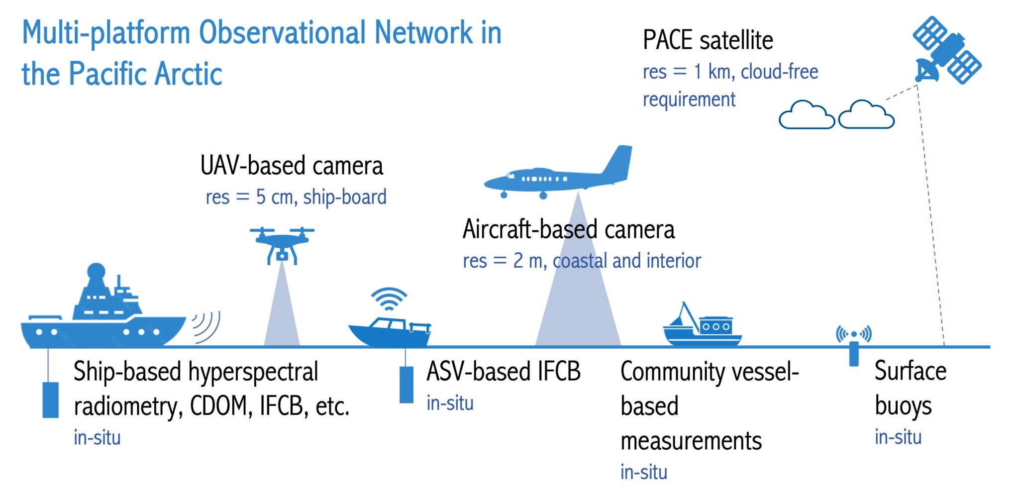
400 miles above the Twin Otter, NASA’s PACE satellite is capturing data with a hyperspectral camera of its own. The satellite, launched earlier this year, is just one layer of a growing web of resources being used to better understand phytoplankton in the Earth’s oceans. A constellation of microSWIFT buoys deployed by the Arctic AIR team this summer are also collecting data in the water, along with samples collected by local boat owners and fellow researchers.
This web is making it possible for the team to do ground-truthing, a method of correlating aerial data with ground data to ensure their sensors are working accurately. Zhang said this is important as the team tries to better understand harmful algal blooms.
“The goal is to try to get as much data as we can, and then try to see if we can tell if there is a potential harmful algae bloom happening down there. We want to overfly that cruise so that they can collect water samples, and we can have the remote sensing data up in the air. That way we can do ground truthing on the data that we collect,” Zhang said.
In the future, Arctic AIR hopes to add a few new pieces of equipment to the mix including the American-made Freefly Alta-X drone and a pole-mounted DALEC hyperspectral camera that can be used on ships. This will further expand their capability to detect and track algal events like one that struck the Bering Strait region in 2022. That bloom is now known to be the largest, most persistent, and toxic ever documented nationwide.
This winter, the team will review their data and optimize their plans before returning to the region in June.


