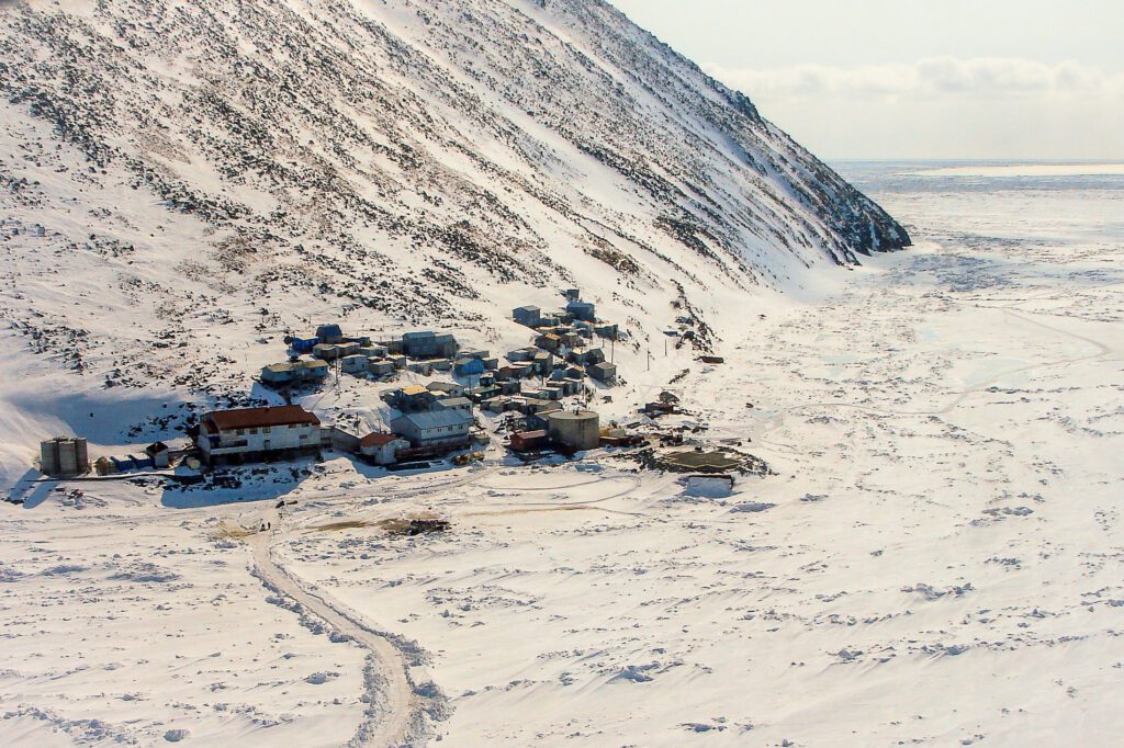
A severe winter storm is expected in western Alaska in the coming days, the National Weather Service projects, bringing blizzard-strength winds, 6-12 inches of new snowfall, and whiteout conditions. The storm, which is forecast to begin in earnest overnight Wednesday into Thursday, may also bring power outages and isolated flooding, especially in areas with sporadic sea ice cover. Gambell, the Weather Service says, may be especially at risk.
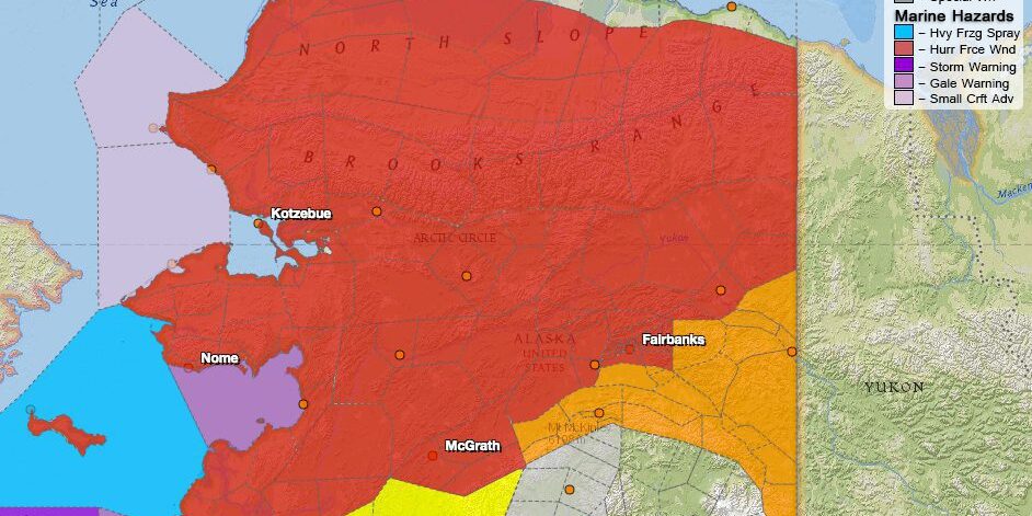
As of mid-day Wednesday, the Weather Service’s online map of Alaska had turned largely red with severe weather alerts; winter storm or blizzard warnings now cover a vast swath of Alaska’s interior, Bering Sea coastal regions, and North Slope. Almost without exception, these alerts cover all of KNOM’s listening region.
Within western Alaska, blizzard or winter weather warnings go into effect as early as Wednesday evening, depending on the specific weather zone, and last throughout most or all of Thursday. Strong winds, gusting up to 40 or 50 miles per hour, will accompany 6-12 inches of new snow accumulation and localized blowing snow and shifting snow drifts, the Weather Service says. Relatively warmer temperatures (into the 30s) may also bring freezing rain and ice accumulation in places. Even though the NWS weather warnings officially expire on or before 12 midnight on Friday, strong gusts of wind are expected to resume during the day on both Friday and Saturday.
Overlapping with western Alaska’s blizzard and winter storm warnings, in many regions, are coastal flood watches, effective through Saturday. A storm surge of 4 to 8 feet is possible for coastal communities on St. Lawrence Island, in the Bering Strait, and throughout the Norton Sound and Yukon Delta, NWS projects, although surge levels may depend on the amount of local sea ice cover. “In places where there is sea ice, there is some uncertainty how to the ice will dampen or mitigate the effects of the storm surge,” states Wednesday’s coastal flood watch for the St. Lawrence Island and Bering Strait Coast. “The effects of ice may vary depending on location.”
NWS emphasizes, however, that “sea ice in Norton Sound will likely break up and become mobile” with the wind gusts expected for the region. “Ice may be lifted by rising water,” the Weather Service warns, “and minor flooding is possible in low lying coastal areas. Ice may also push onshore.”
This week’s storm may have the most acute impacts on St. Lawrence Island and Gambell in particular, where “the threat for coastal flooding is highest,” NWS says. “The worst conditions are expected at Gambell and in the Bering Strait where there is little ice present,” forecasters stated in a “special weather statement” on Tuesday. The wind gusts are expected to be strongest on the Island (up to 60 miles per hour). “The runway and other low lying areas near Gambell may become inundated,” NWS specified on Wednesday.
Overall, western Alaska’s coastal residents “should prepare for minor flooding by moving boats and other belongings away from the coast,” NWS urges. Power outages may occur, as well, especially “in the Western Interior, where the winds could blow trees over Thursday and Friday.”
As always, the weather service — and KNOM — discourage outdoor activity or travel during such inclement conditions. KNOM AM/FM weather forecasts, whenever possible, will include the most up-to-date emergency warnings or advisories; listeners within western Alaska are encouraged to keep an ear for our top-of-the-hour forecasts on 96.1 FM, 780 AM — and to place high priority on safety in the coming days.


